 12.2 °C,
4 m/s,
76.5 %
12.2 °C,
4 m/s,
76.5 % News
“Jelgavas autobusu parks” Ltd. has developed a new city public transport route scheme, which allows passengers to navigate city bus routes much more conveniently. The map of Jelgava shows in details the timetable of each bus route and its stops. New maps are now being launched at stops – in total, around 90 city bus stops.
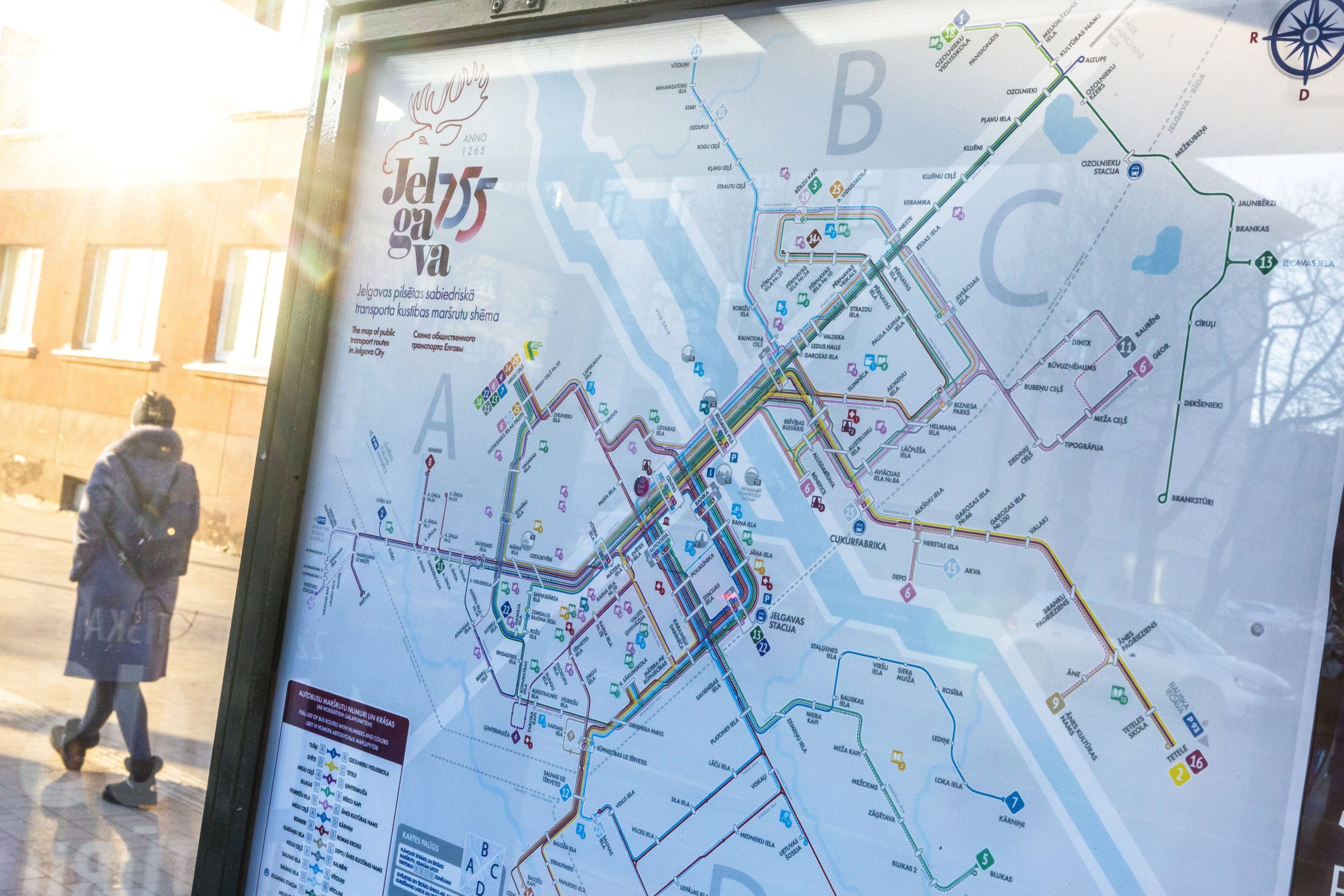
“Over time, the route network has changed and expanded significantly, as have technological capabilities. The map is a visual bridge that will make the city’s public transport networks more user-friendly and understandable. You do not need to know the names of bus routes when you arrive in the city as a guest or tourist, as it is possible to orientate by the different color of the route.” emphasizes Gints Burks, board member of “Jelgavas autobusu parks” Ltd.
At each stop on the map is printed QR code – read on a smart device and takes you to the “Jelgavas autobusu parks” Ltd. homepage, where you can find detailed information on all city bus schedules and arrival times. By scanning the QR code on the route list for a particular stop, the passenger will already know online how long the bus will arrive at that stop, whether it is on schedule or with a delay. “The map is a small, visible part of the iceberg that reveals an interactive system that knows exactly where a particular bus is, when it will arrive at a particular stop and where it will get you. This information is available to anyone online on their smartphone,” says Gints Burks.
In addition to all 20 city bus routes and their stops, the new map provides other useful information about kindergartens, schools, hospitals, polyclinics and cultural institutions, tourist attractions and more.